(By Kosturi Sen, Vazishta Rohinton Mahuvawala, Aaheli Bera, and Balaji Vedharajan)
On 6 and 7 June 2026, OMCAR Foundation, together with the Marine Conservation Leadership Programme 2026 fellows, organised a two-day hands-on workshop on “GIS Mapping of Mangrove and Seagrass Habitats, and Drone Photogrammetry Techniques for Young Professionals” at the OMCAR Palk Bay Centre, Velivayal, Tamil Nadu, India.It is a non profit event.
The workshop was designed to strengthen the technical capacity of young students and professionals working in marine and coastal conservation. It focused on the use of Geographic Information Systems, drone imagery, Google Earth Pro, QGIS, and photogrammetry tools for mapping and monitoring coastal ecosystems such as mangroves, seagrass beds, sand dunes, and restoration sites.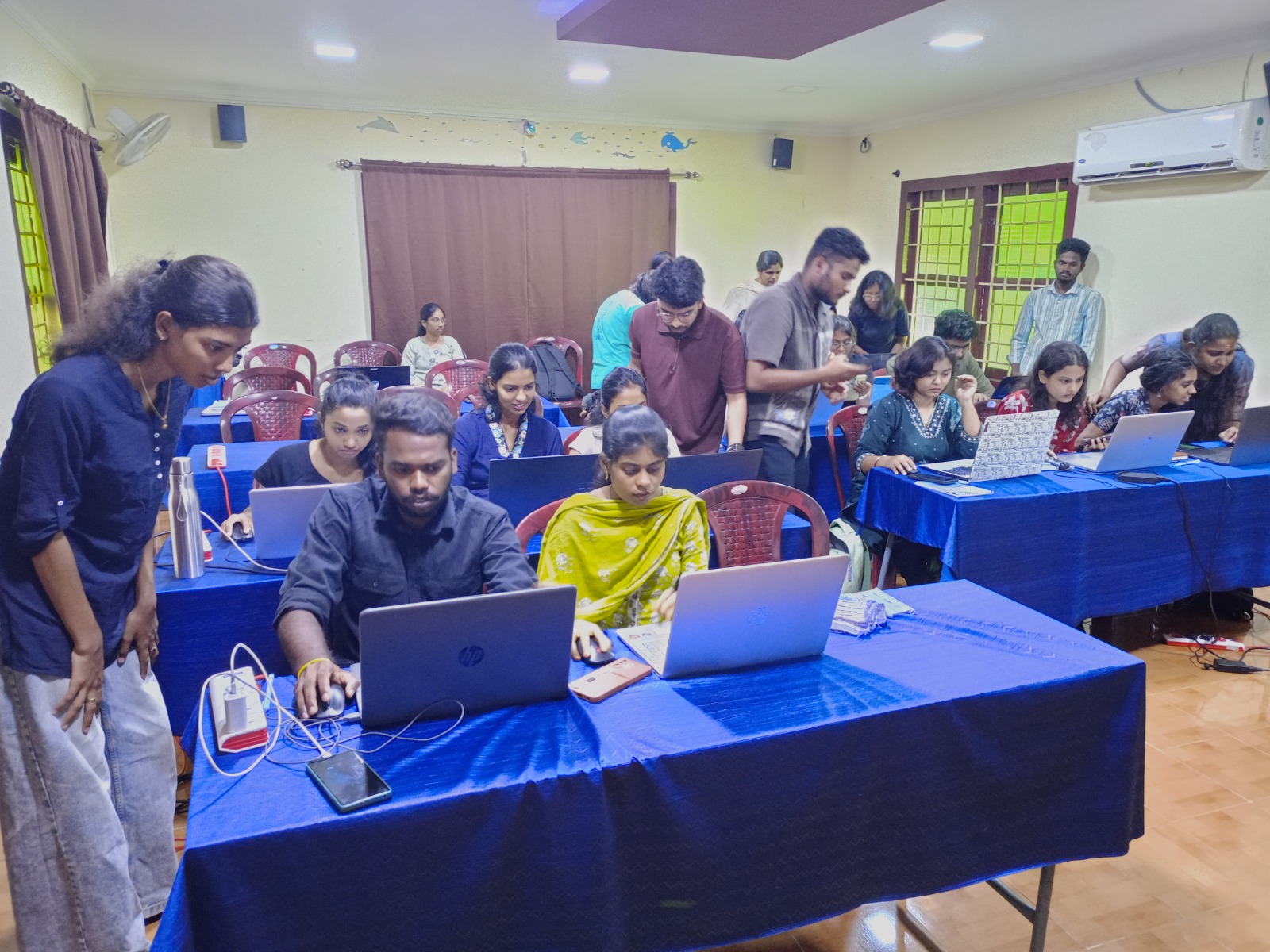
In this peer-to-peer learning model, the Marine Conservation Leadership Fellows of OMCAR Foundation, who were trained in GIS, are sharing their knowledge with workshop participants.
The programme began with a traditional lamp-lighting ceremony, followed by a tree-planting activity under the theme “Ek Ped Maa Ke Naam”. Fruit tree saplings, including guava, mango, jackfruit, and lemon, were planted on the OMCAR campus by Dr. Deepak Samuel V, Dr. Balaji Vedharajan, Mr. G. Murugesan, the MCL 2026 fellows, and workshop participants. The activity reflected the wider spirit of ecological responsibility and collective action that guided the workshop.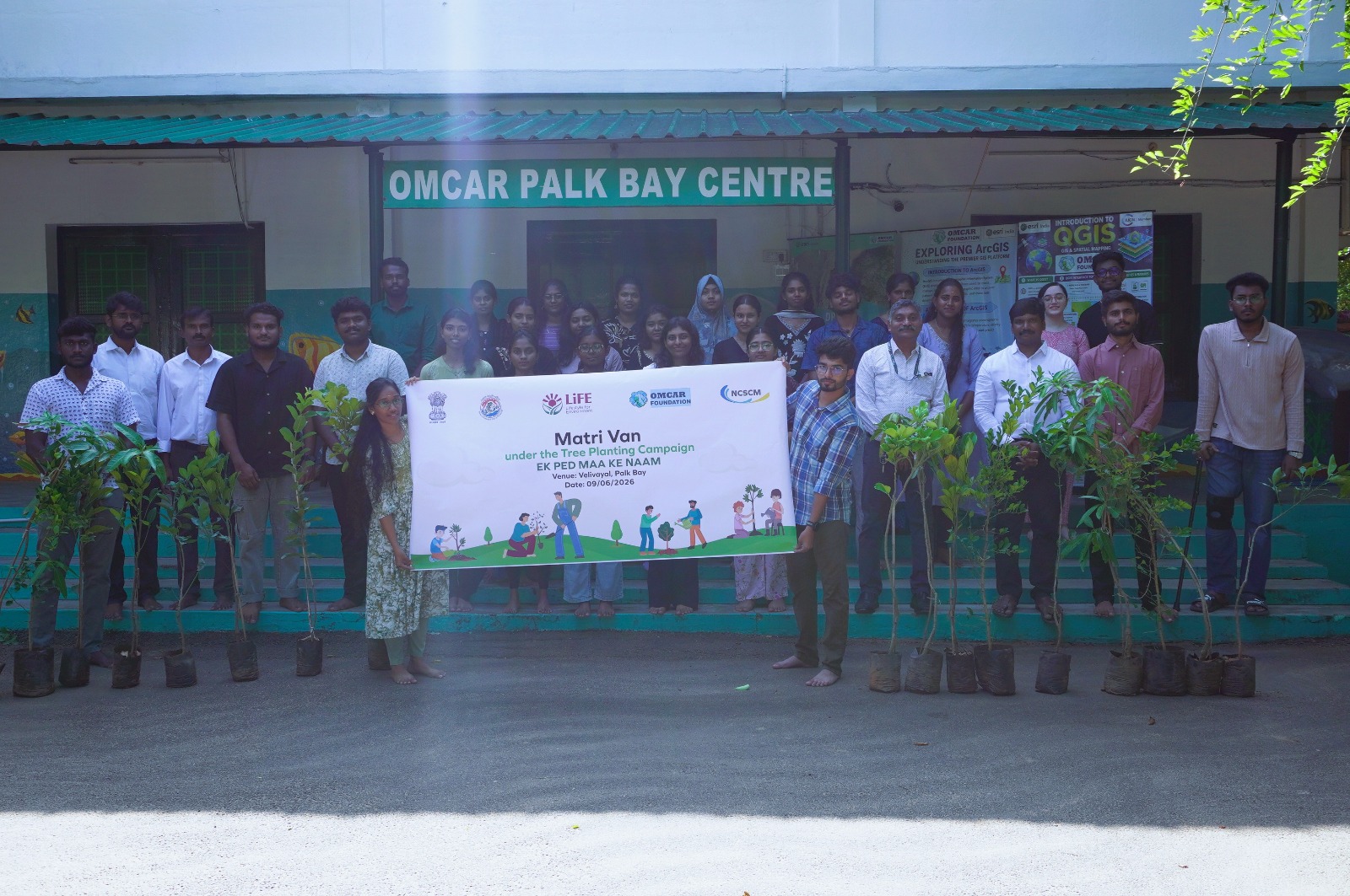
Dr. Balaji Vedharajan, Founder and Director of OMCAR Foundation and member of the IUCN Commission on Education and Communication, opened the workshop by introducing the conservation importance of Palk Bay, especially for dugongs and seagrass ecosystems. He also highlighted how geospatial technologies can support evidence-based conservation planning, habitat monitoring, restoration site selection, and community-led coastal protection.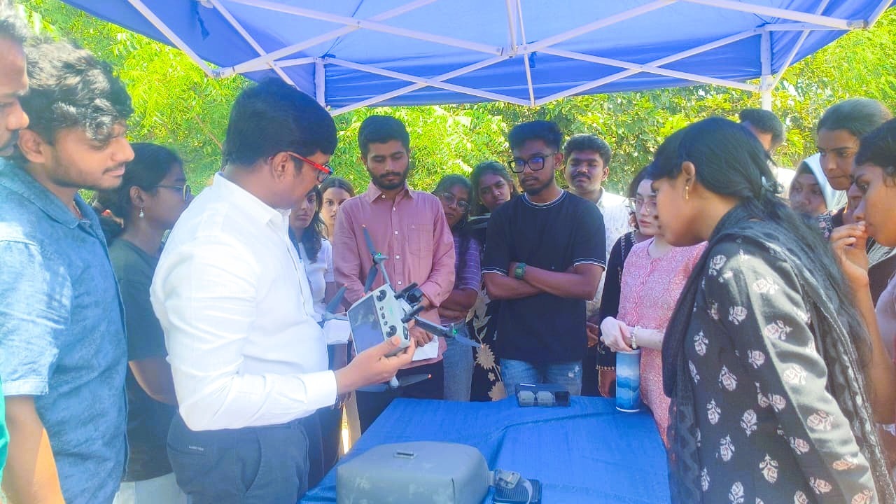
Dr. Deepak Samuel V, Scientist-E at the National Centre for Sustainable Coastal Management, Chennai, addressed the participants on marine ecology, restoration, and the importance of nurturing young professionals in conservation science. His interaction with the participants and MCL fellows added strong encouragement to the learning environment.
A key technical session was delivered by Dr. Tune Usha, Scientist-G and Group Head, Coastal Hazards, National Centre for Coastal Research, Ministry of Earth Sciences, Government of India. Her session covered coastal ecosystem mapping from traditional methods to advanced geospatial approaches. She introduced participants to the use of Airborne Laser Terrain Mapping, coastal hazard assessment, sand dune morphometry, seagrass mapping, blue carbon assessment, and applications of geospatial tools in coastal vulnerability and risk studies.
The workshop also included field-based drone operation demonstrations and hands-on practice. Participants were introduced to drone handling, flight planning, image capture, and the importance of drone-based data collection for ecological research. This was followed by an introduction to drone photogrammetry workflows using Agisoft Metashape, including image import, point cloud generation, mesh creation, 3D model development, and orthomosaic production.
A major strength of the workshop was its peer-to-peer learning model. The MCL 2026 fellows played an active role as trainers and facilitators. MCL fellows introduced participants to drone regulations in India, GIS concepts, Google Earth Pro, and QGIS. Participants were guided through practical exercises using point, line, and polygon tools, and they developed simple study area maps and printable map layouts.
On the second day, the training focused strongly on QGIS-based digitisation 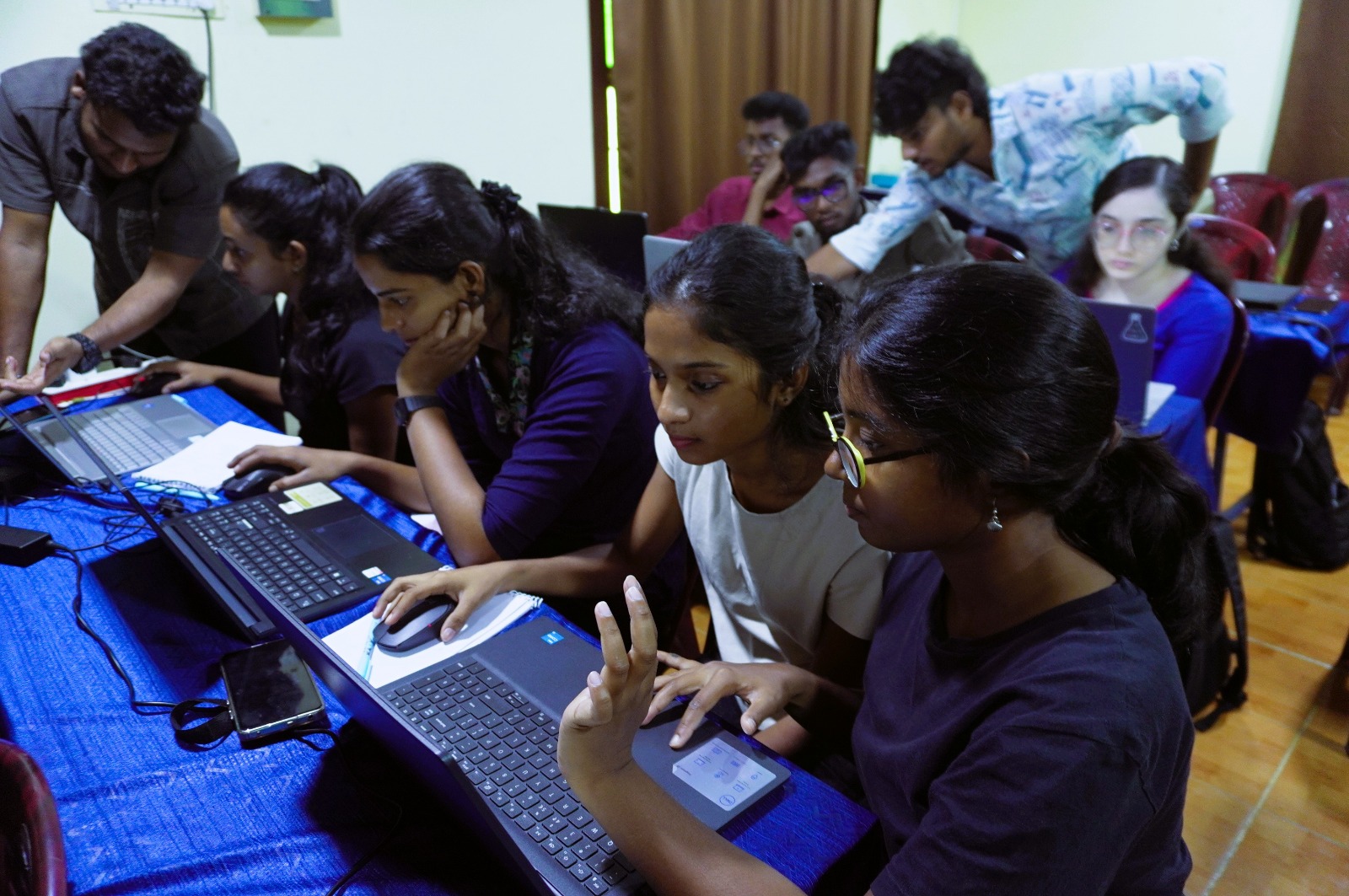 and map preparation. With support from the MCL fellows, participants created map layouts representing different landforms and structures. The practical sessions helped participants understand how spatial data can be converted into conservation-relevant maps for research, field planning, and communication.
The two-day programme concluded with participant presentations, certificate distribution, and a valedictory session. Students and young professionals from different universities and institutions shared that the workshop helped them understand the value of GIS, drone photogrammetry, and mapping tools for their future studies and conservation work.
Participant feedback reflected the usefulness of the programme. Several participants appreciated the opportunity to learn practical mapping skills free of cost, while others highlighted the supportive role of the MCL fellows and the relevance of drone photogrammetry and QGIS for young learners.
The workshop demonstrated how locally rooted conservation organisations can build technical capacity among young professionals by combining field experience, open-source tools, peer learning, and applied conservation needs. For OMCAR Foundation, this programme was not only a technical training event, but also part of a larger effort to prepare the next generation of marine conservation leaders for work in dugong, seagrass, mangrove, and coastal ecosystem conservation.
Through such capacity-building efforts, OMCAR Foundation continues to strengthen young leadership, community-based conservation, and science-driven action for the protection of Palk Bay’s fragile coastal and marine ecosystems.